
Tech & Engineering Innovations
Planetary Health & Sustainability
Discovering Earth & Space
Digital | In Person
English
Discussion
Talk
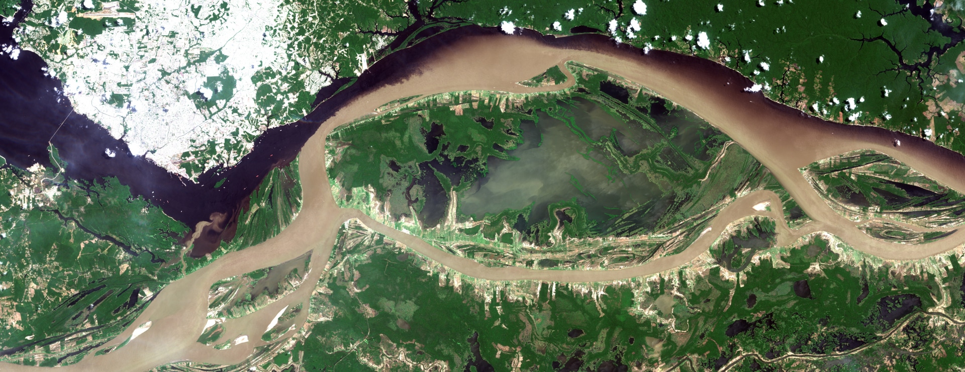
From Space we see it Better: What Remote Sensing can tell us about Earth
Embassy of Brazil in Berlin | Igor Ogashawara, Evlyn Leao de Moraes Novo, Claudia Guimarães-Steinicke, Wanderson de Sousa Mendes, Alby Duarte Rocha, Gabriel Medeiros Abrahão
Revealing what is not always captured by human eyes helps scientists to unfold history, understand complex events and forecast possible futures
Remote sensing is the science of acquiring information about the Earth’s surface without actually being in contact with it.
Since it started, decades ago, the technology has become so precise that, from so far way, it allows us to “see” things from a granular scale to a planetary one. Suddenly, it is possible to close gaps of information, track connections between different phenomena and broaden our comprehension of the world. At the same time, the amount of collected data requires a completely new set of expertise. This all brings science to an entirely different level.
Join us and learn about some exciting applications of remote sensing – from observing phytoplankton bloom in lakes and oceans and improving water management to mapping the best soil for agriculture and analyzing the behavior of plants in a changing climate. Also, hear about how Brazil contributed to the field and made data accessible to everyone.
About the Venue
Embassy of Brazil in Berlin
Wallstrasse 57
Berlin, Berlin 10179 Germany
Berlin, Berlin 10179 Germany

Igor Ogashawara
Leibniz-Institut für Gewässerökologie und Binnenfischerei (IGB-Berlin)
Evlyn Leao de Moraes Novo
Brazilian National Institute for Space Research (INPE)
Claudia Guimarães-Steinicke
Universität Leipzig
Wanderson de Sousa Mendes
Leibniz-Zentrum für Agrarlandschaftsforschung (ZALF)
Alby Duarte Rocha
Technische Universität Berlin
Gabriel Medeiros Abrahão
Potsdam Institute for Climate Impact Research (PIK)